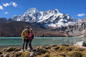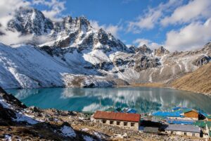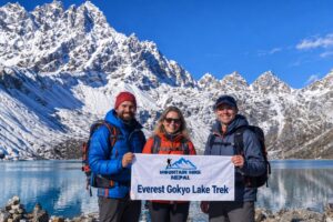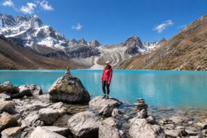
The Everest Gokyo Lakes Trek is an 11-day trek from Lukla to Gokyo Ri (5,357m), priced from $939 to $1,249 per person. The route passes Namche Bazaar, Dole, and Machhermo to the turquoise Gokyo Lakes, where Everest, Lhotse, Makalu, and Cho Oyu all appear from the summit.
This is the Everest region without the crowds — the Gokyo Valley sees a fraction of the traffic through Gorakshep and Kala Patthar. Dawn from Gokyo Ri rivals anything on the standard route. See our acclimatisation guide or Gokyo vs EBC comparison first.
We’re a small Kathmandu-based operation, not a call centre. Every guide on this route knows the Gokyo Valley — current Cho La conditions, warm teahouses, and altitude pacing between Namche and Machhermo. We handle flights, permits, and acclimatisation ourselves.
Want the full circuit? Crossing Cho La Pass (5,420m) to EBC adds 3–4 days — tell us your dates. Prefer shorter? Our Everest View Trek covers similar ground in 5 days. Message us on WhatsApp with your travel month.
| Trip Details | Information |
|---|---|
| Trip Name | Everest Gokyo Lakes Trek |
| Duration | 10 Nights / 11 Days |
| Maximum Altitude | 5,357m — Gokyo Ri |
| Major Highlights | Gokyo Lakes, Gokyo Ri, Ngozumpa Glacier, Namche Bazaar, Sherpa villages |
| Trek Difficulty | Moderate to Challenging |
| Trek Start / End | Lukla |
| Best Season | Spring (March–May) and Autumn (September–November) |
| Low Season | Winter — cold but very clear mountain views |
| Avoid | Monsoon — June, July, August |
| Accommodation | Teahouse lodges throughout |
| Meals Included | Breakfast, Lunch and Dinner (all trekking days) |
| Permits Required | Sagarmatha National Park + Khumbu Pasang Lhamu (both included) |
| Region | Everest Region — Khumbu and Gokyo Valley, Nepal |
Kathmandu → Lukla → Phakding → Namche Bazaar → Dole → Machhermo → Gokyo → Gokyo Ri (5,357m) → Dole → Namche Bazaar → Lukla → Kathmandu
Most trekkers in the Everest region walk the same trail. Lukla to Namche. Namche to Dingboche. Dingboche to Lobuche. Gorakshep to Base Camp. Then back, the same trail both directions. Thousands do exactly this every October.
The Gokyo Lakes Trek goes somewhere different. The Gokyo Valley branches northwest from Namche — quieter and far less walked than the main EBC trail. The Ngozumpa Glacier, Nepal’s longest, runs the length of the valley beside the trail, and the turquoise Gokyo Lakes are sacred to both Hindu and Buddhist tradition. Gokyo Ri (5,357m) puts Everest, Cho Oyu, Lhotse, and Makalu on a single horizon.
This route is moderate to challenging. The altitude gain above Namche is steady and significant — 5,357m at Gokyo Ri is higher than Annapurna Base Camp, and it requires genuine preparation. Trekkers who arrive fit and acclimatise correctly tend to describe Gokyo Ri at dawn as one of the best mornings of their trip.
Peak Season (Spring: March–May | Autumn: September–November): During these months, Lukla-bound flights depart from Manthali Airport in Ramechhap rather than Kathmandu. Plan on a road transfer of about 4–5 hours from Kathmandu to Ramechhap ahead of the short flight onward.
Off-Peak Season (Winter: December–February | Monsoon: June–August): Flights typically operate directly from Kathmandu once the peak-season arrangement isn’t in effect, though airline scheduling and weather conditions still apply as always.
This isn’t a Mountain Hike Nepal policy — it’s set by Nepal’s Civil Aviation Authority (CAAN), which reroutes scheduled fixed-wing Lukla flights through Manthali Airport in Ramechhap during the busiest trekking months to relieve pressure on Tribhuvan International Airport (TIA). Every airline running this route follows the same arrangement, Tara Air, Summit Air, and Sita Air included, which is why the Ramechhap transfer comes standard with every Everest Gokyo Lakes Trek booking.
Want to look at helicopter options instead of the fixed-wing flight? Our FAQ on Lukla flight alternatives covers pricing and pickup points in detail.
per person
Recommended
per person
per person
Value Added
per person
Altitude: 2,610m | Flight: 35 minutes | Trek: 3–4 hours | Accommodation: Teahouse | Meals: Breakfast, Lunch, Dinner
The Everest Gokyo Lakes Trek begins with the mountain flight to Lukla — 35 minutes through some of the finest aerial scenery in the world. During spring and autumn peak season, this flight departs from Ramechhap Airport rather than Kathmandu, included with the midnight transfer from your Kathmandu hotel. The Tenzing-Hillary Airport at Lukla sits at 2,860m on a ridge above the Dudh Koshi valley. The runway ends at a cliff. The landing is precise and completely normal, but it makes an impression.
From Lukla the trail descends gently to Phakding at 2,610m, following the Dudh Koshi river through pine-forested hillsides and small Sherpa settlements. The first day is short and deliberately easy. Your body has already gained significant altitude from Kathmandu by flight, and Phakding gives it the evening to begin adjusting.
Altitude: 3,440m | Trek: 5–6 hours | Ascent: +830m | Accommodation: Teahouse | Meals: Breakfast, Lunch, Dinner
The trail climbs from Phakding through the Hillary Suspension Bridge, the famous swinging bridge above the Dudh Koshi gorge that most Everest region trekkers photograph, and into Sagarmatha National Park. The park checkpoint at Jorsale requires your Sagarmatha permit, and your guide handles all documentation.
Above Jorsale the trail climbs steeply to Namche Bazaar, a long, demanding ascent through pine forest that gains over 800m before the first view of Everest appears through a gap in the ridge above the trail. Namche arrives as a steep horseshoe of teahouses, lodges, bakeries, and gear shops carved into the hillside at 3,440m. It’s the Sherpa capital of the Everest region, and the most comfortable overnight stop between Lukla and the high valley.
Altitude: 3,440m | Hike: 3–4 hours | Accommodation: Teahouse | Meals: Breakfast, Lunch, Dinner
The acclimatisation day at Namche isn’t optional. The body needs 24–48 hours at this altitude before ascending further, and skipping or shortening this day increases AMS risk significantly above 4,000m. It’s the most important day in the itinerary that involves no vertical progress, and the most important day for making vertical progress possible afterward.
The acclimatisation hike climbs to the Everest View Hotel ridge at approximately 3,880m, with Everest, Lhotse, Ama Dablam, and Thamserku visible simultaneously on clear mornings. Descend to Namche for lunch and a slow afternoon. Visit the Namche Saturday market if your acclimatisation day falls on the right day of the week.
Altitude: 4,200m | Trek: 5–6 hours | Ascent: +760m | Accommodation: Teahouse | Meals: Breakfast, Lunch, Dinner
The trail leaves Namche and branches northwest into the Gokyo Valley, diverging from the standard EBC route that continues northeast toward Tengboche. This is where the Everest Gokyo Lakes Trek becomes a different experience.
The path climbs through rhododendron and juniper forest above the main Khumbu valley, passing the villages of Khumjung and Mong La before descending slightly to the Dudh Koshi and climbing again to Dole at 4,200m. The trail is less trodden than the EBC route above Namche. The teahouses are smaller. The valley is quieter. The views of Cho Oyu begin to dominate the northern horizon.
Altitude: 4,470m | Trek: 3–4 hours | Ascent: +270m | Accommodation: Teahouse | Meals: Breakfast, Lunch, Dinner
A shorter day designed to let the body adapt to the altitude gain of Day 4. The trail climbs gradually through the upper Gokyo Valley, increasingly open, increasingly alpine, increasingly dominated by the peaks above. Machhermo sits at 4,470m at the edge of the permanent glacier zone.
This is a critical acclimatisation stop. Altitude effects above 4,000m can appear suddenly here for some trekkers — headache, reduced appetite, disrupted sleep. Report every symptom to your guide immediately. Drink 3–4 litres of water. Eat a full dinner. The Ngozumpa Glacier comes into view for the first time tomorrow.
Altitude: 4,750m | Trek: 3–4 hours | Ascent: +280m | Accommodation: Teahouse | Meals: Breakfast, Lunch, Dinner
The trail reaches Gokyo, and everything changes.
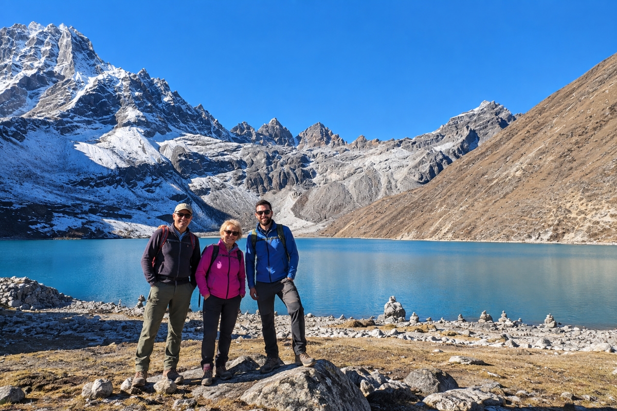
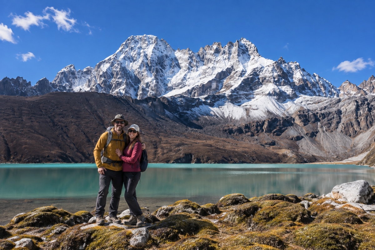
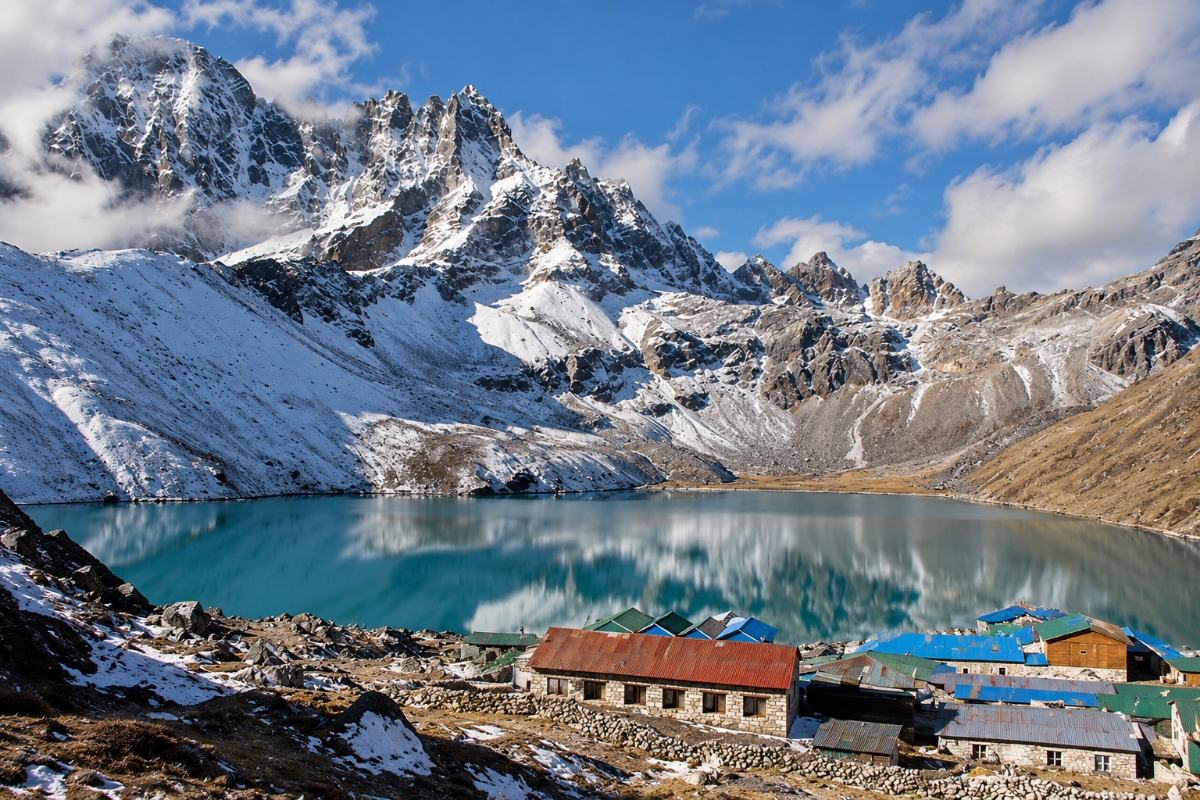
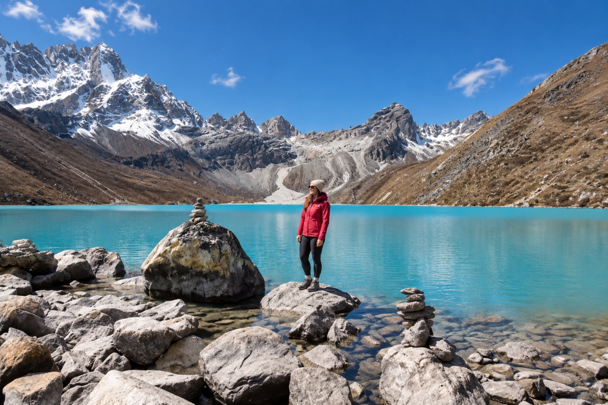
The Ngozumpa Glacier appears beside the trail above Machhermo — Nepal’s longest glacier, 36 km long, spilling down from the base of Cho Oyu into the valley floor. The first Gokyo Lake appears. Then the second. By the time Gokyo village arrives at 4,750m, the third lake, Dudh Pokhari, spreads in deep turquoise below the moraine. Gokyo Ri rises directly above the village.
Arrive before 2pm. Spend the afternoon walking beside the lake, visiting the fourth lake if conditions allow, and resting before the Gokyo Ri summit attempt tomorrow. The teahouses at Gokyo are small and simple, and some of the finest-situated teahouses in the entire Everest region.
Altitude: 5,357m high point — return overnight to 4,750m | Trek: 4–5 hours | Accommodation: Teahouse | Meals: Breakfast, Lunch, Dinner
The alarm goes off at 4:30am.
The trail climbs steeply from Gokyo village to Gokyo Ri at 5,357m in 2–3 hours on a clear but demanding path above the lake. No technical sections, no equipment required beyond warm layers and trekking poles. The difficulty is altitude — every step above 5,000m is a genuine effort.
The summit at 5,357m delivers the finest mountain panorama in the Gokyo Valley. Everest (8,849m), Lhotse (8,516m), Makalu (8,485m), and Cho Oyu (8,188m) rise across the horizon simultaneously — four of the world’s six highest mountains visible from a single vantage point. The Ngozumpa Glacier fills the valley floor below. The five Gokyo Lakes shine in the early light. Most trekkers stand completely still for several minutes before taking a photograph.
This day also serves as an acclimatisation hike, returning to Gokyo to sleep at 4,750m after reaching 5,357m. This prepares the body for the descent and any optional extension toward the Cho La Pass.
Altitude: 3,440m | Trek: 6–7 hours | Descent: -1,310m | Accommodation: Teahouse | Meals: Breakfast, Lunch, Dinner
The descent begins. The trail retraces through Machhermo and Dole, dropping back into the rhododendron and juniper zone below 4,000m. Breathing becomes progressively easier, and the body responds quickly to the altitude reduction — energy returns and the pace lifts naturally.
Namche arrives in the late afternoon. The bakeries, the warm teahouses, and the hot showers are genuine pleasures after two nights above 4,500m. Use the Namche evening for a proper meal, a long shower, and full device charging before the final trail days.
Altitude: 2,610m | Trek: 4–5 hours | Descent: -830m | Accommodation: Teahouse | Meals: Breakfast, Lunch, Dinner
The descent from Namche follows the same Dudh Koshi trail back through the Hillary Suspension Bridge to Phakding. The trail is familiar and the pace is easy. Phakding is a comfortable overnight stop with good teahouses and the relaxed atmosphere of a valley that sits well below altitude.
Set aside the guide and porter tips tonight. Present them in the morning before the Lukla walk — a gesture that matters to the people who carried your load and walked every step of the Gokyo Valley beside you.
Altitude: 2,860m | Trek: 3–4 hours | Accommodation: Teahouse | Meals: Breakfast, Lunch, Dinner
The final trekking day climbs from Phakding back up to Lukla, the same trail in reverse from Day 1. The walk takes 3–4 hours and feels genuinely short after nine days of Himalayan terrain. Lukla has good restaurants, reliable electricity, and a very specific atmosphere — trekkers finishing routes from across the Khumbu all converge here before their flights.
Confirm the morning flight time with your guide tonight. Lukla flights depart early and weather determines departure windows. Keep all personal luggage consolidated and within carry-on limits for the Lukla-Kathmandu leg.
Flight: 35 minutes | Accommodation: Hotel, Kathmandu | Meals: Breakfast
The mountain flight returns to Kathmandu. Thirty-five minutes from the cliff-edge runway at Lukla back to Tribhuvan International Airport, with the Himalaya visible through the window for most of the journey.
The Everest Gokyo Lakes Trek ends on arrival in Kathmandu.
Eleven days. 5,357m. The five Gokyo Lakes. The Ngozumpa Glacier. Gokyo Ri at dawn. Done.
The Everest Gokyo Lakes Trek is an 11-day guided high-altitude trek in Nepal’s Everest region — specifically the Gokyo Valley, west of the standard EBC route. It reaches Gokyo Ri at 5,357m, walks beside the Ngozumpa Glacier (Nepal’s longest), and visits the five sacred Gokyo Lakes. The route is quieter than EBC and delivers arguably finer mountain panoramas from Gokyo Ri.
Gokyo Ri, at 5,357m, sits somewhat lower than Kala Patthar on the EBC route, which reaches 5,644m — but Gokyo Ri delivers Everest, Lhotse, Makalu, and Cho Oyu simultaneously from the summit, a panorama Kala Patthar doesn’t match. The Gokyo Valley also carries significantly fewer trekkers than the standard EBC trail above Namche. The EBC route visits the base camp at 5,364m, which Gokyo does not, but the Gokyo and EBC combined route via the Cho La Pass covers both.
Yes — the Gokyo and EBC combined route crosses the Cho La Pass at 5,420m from Gokyo, descends to Dzongla, continues to Gorakshep and Everest Base Camp at 5,364m, and climbs Kala Patthar at 5,644m before returning to Lukla. This circuit runs 14–15 days total and is the finest single Everest region itinerary available. Contact us to plan the combined route.
The trek is rated moderate to challenging. The altitude gain above Namche is sustained and significant — Gokyo at 4,750m and Gokyo Ri at 5,357m are serious high-altitude objectives. The acclimatisation schedule is carefully structured with rest days at Namche and shorter walking days above 4,000m. Good physical fitness and 8 weeks of specific preparation before departure are strongly recommended.
Two permits are required — the Sagarmatha National Park Permit and the Khumbu Pasang Lhamu Rural Municipality Permit. Both are included in Mountain Hike Nepal’s package price. Your guide collects and presents all permits at every checkpoint from Jorsale through to the upper valley.
Yes — round-trip domestic flights are included in Mountain Hike Nepal’s package price. During spring and autumn peak season, most flights operate from Ramechhap Airport rather than Kathmandu, and the round-trip sharing transfer from Kathmandu to Ramechhap (midnight departure, 5:00–5:30am airport arrival) is also included. Mountain Hike Nepal coordinates all flight bookings, transfer timing, and any weather-related rescheduling as part of the package, so you never organise the Ramechhap logistics independently — we handle it from the Kathmandu pickup to the Lukla landing.
October and November are the finest months — post-monsoon clarity, stable weather, and reliable Gokyo Ri summit conditions. April and May are the best spring months, with clear skies before pre-monsoon cloud builds. The Cho La Pass may carry ice in March and December — confirm conditions with us before booking winter or early spring departures.
The standard 11-day route starts from USD 939 per person for groups of 8–12 and USD 1,249 for solo trekkers — guide, porter, Lukla flights, all permits, all trek meals, and accommodation included. The Gokyo and EBC combined route via Cho La Pass is priced separately. Contact us for combined circuit pricing.
It runs along the B.P. Highway east through Bhaktapur, Sanga, and Dhulikhel before reaching Manthali in Ramechhap district. Some stretches wind through hill terrain with tight turns, which is why we only use drivers experienced on this specific overnight route.
They could, technically, but Nepal’s Civil Aviation Authority reroutes them through Manthali Airport in Ramechhap during peak trekking season specifically to ease congestion at Tribhuvan International Airport. It’s a nationwide policy, not something particular to any single operator or airline.
Yes, that’s an option — travel to Manthali the afternoon before and spend the night there instead of doing the overnight drive from Kathmandu. Most trekkers still pick the overnight transfer anyway, since it keeps them in Kathmandu one extra night rather than a Ramechhap guesthouse.
That comes down to weather and airline capacity, not something within our control directly. If it happens, we work with the airline to rebook you on the next departure, and we’ll discuss a helicopter alternative with you if the delay puts the rest of your itinerary at risk.
Planning your trek? These guides cover the details this page doesn’t go deep on: