Langtang Valley altitude sickness can affect trekkers above 3,500 meters, especially near Kyanjin Gompa and Tserko Ri. This image illustrates common high-altitude symptoms such as headache, exhaustion, and fatigue experienced during the Langtang Valley Trek in Nepal.Read More
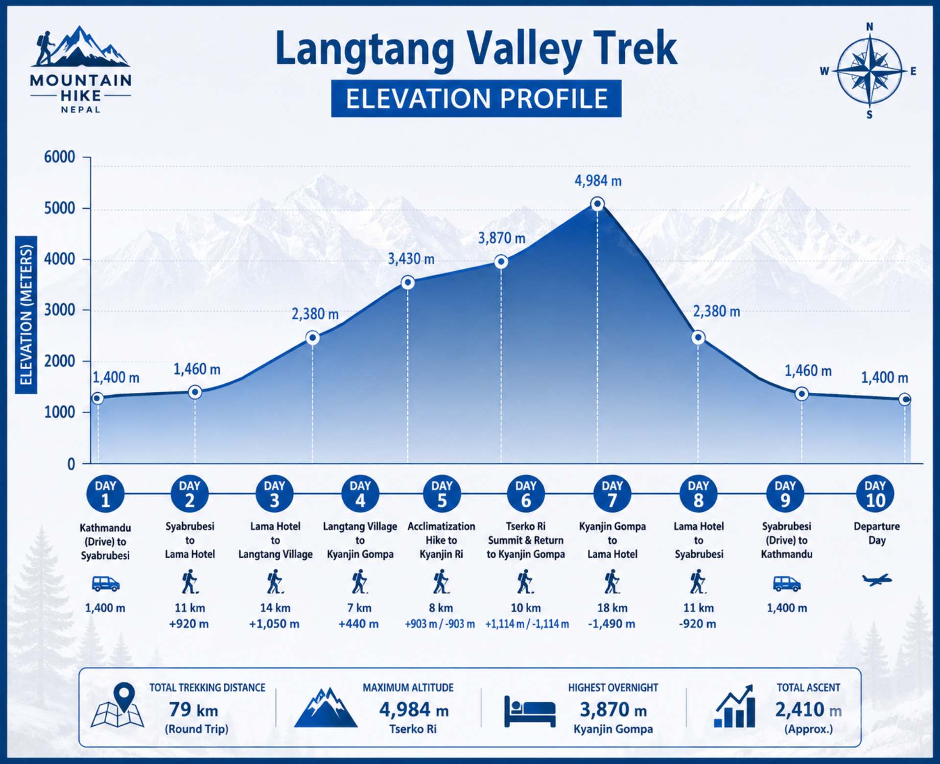
The Langtang Valley Trek distance covers approximately 79 km round trip through Langtang National Park. This elevation profile map shows the daily trekking distance, altitude gain, overnight stops, Kyanjin Gompa elevation, and the Tserko Ri summit route in a clear visual format.Read More
When you book with an account, you will be able to track your payment status, track the confirmation and you can also rate the tour after you finished the tour.