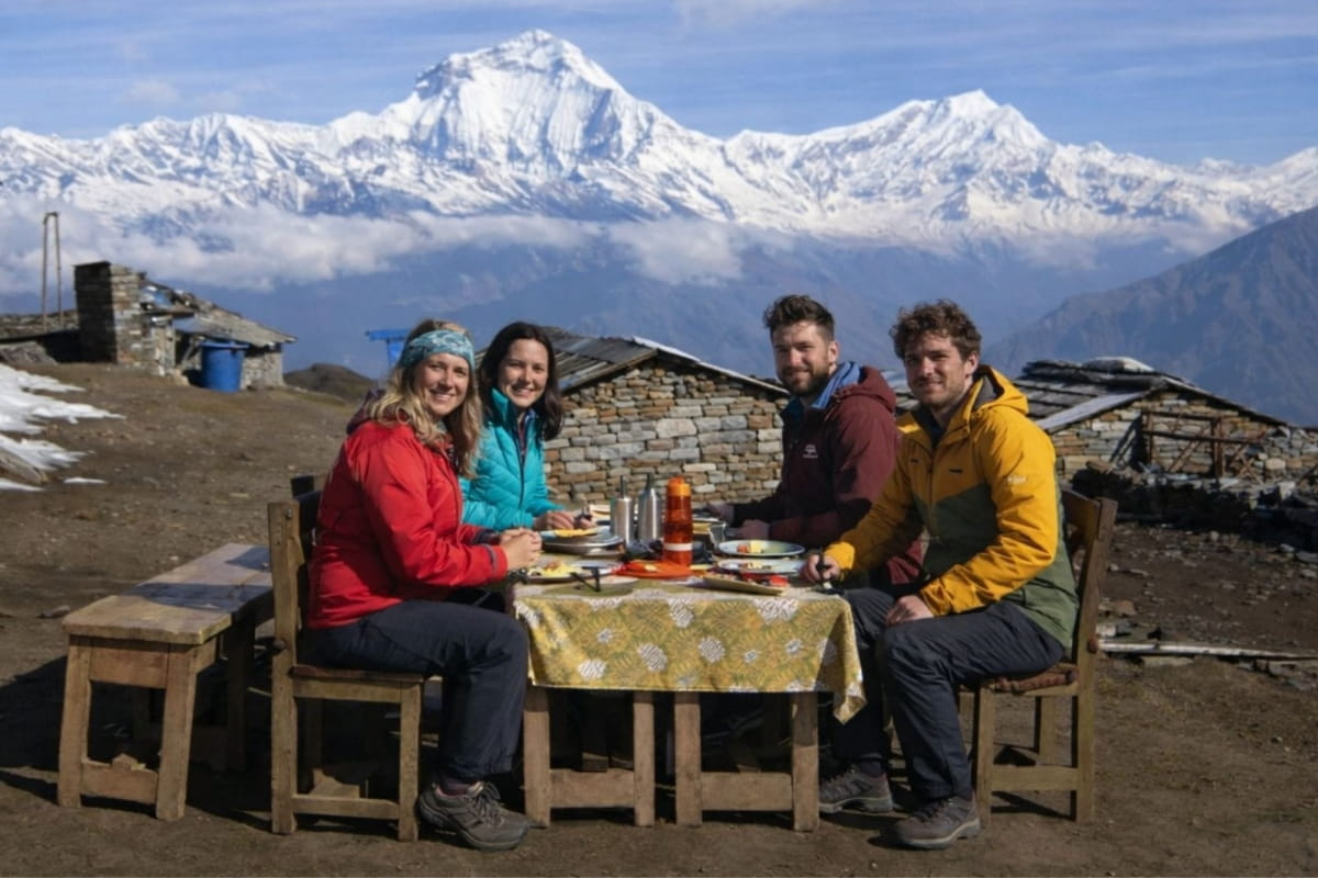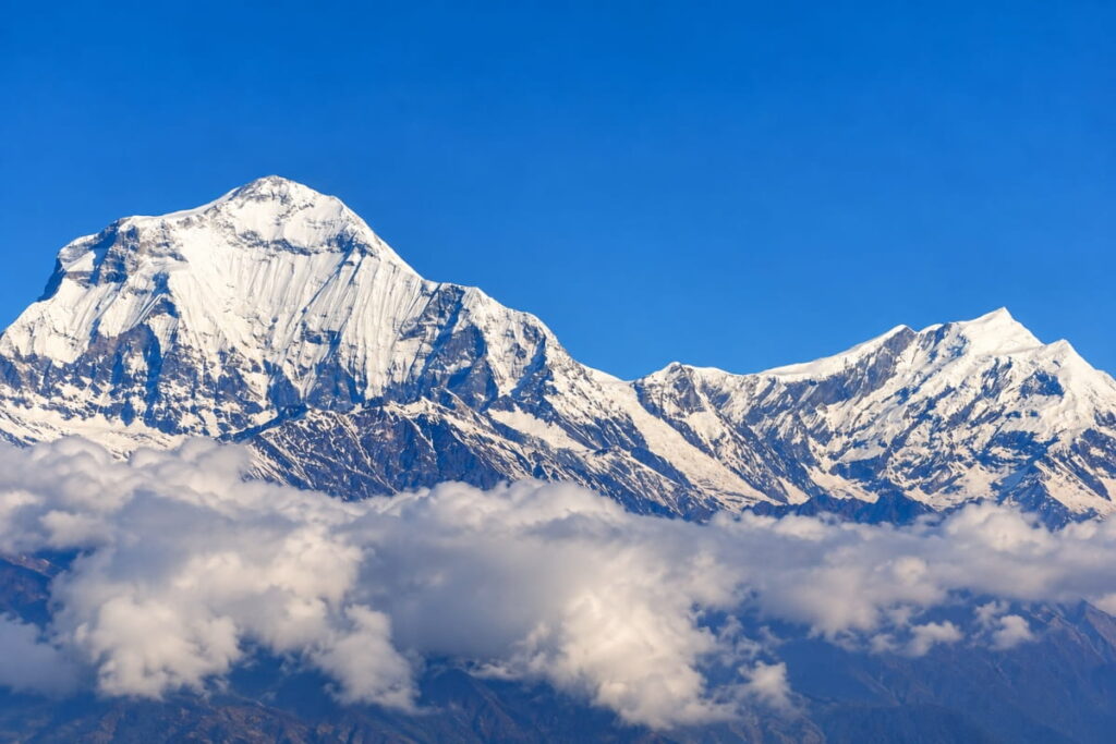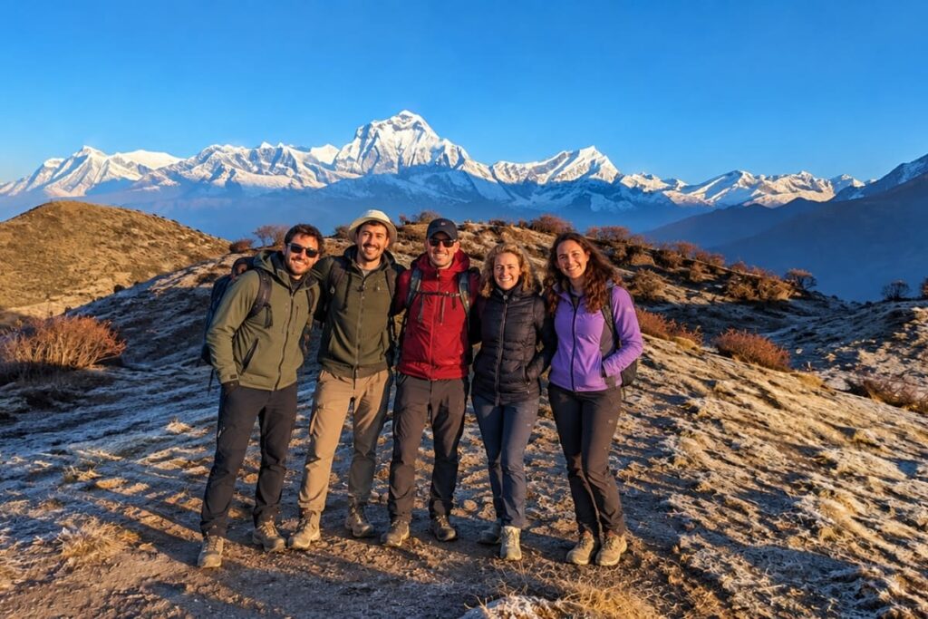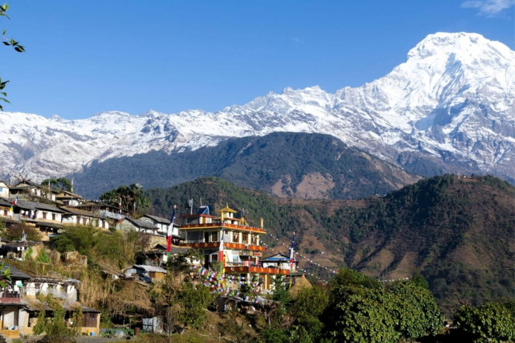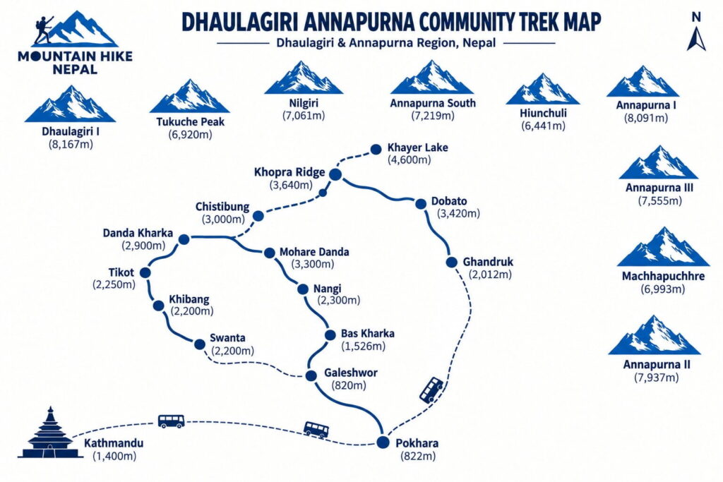
The Dhaulagiri Annapurna Community Trek is a 13-day community-based trek through the quiet foothills between the Dhaulagiri and Annapurna ranges. The route runs from Galeshwor to Khopra Ridge and Ghandruk, priced from $695 to $949 per person.
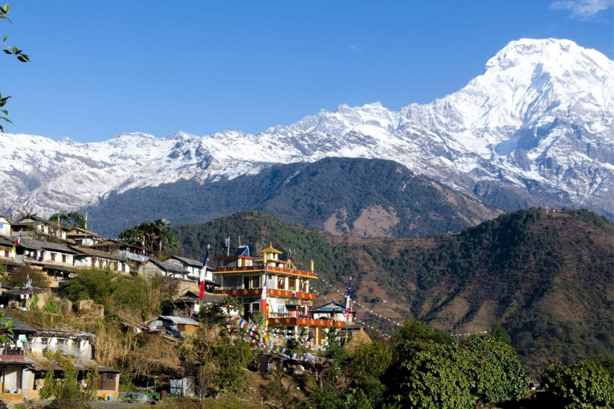
Most nights are spent in community lodges and homestays run by Magar families in villages like Bas Kharka, Nangi, Tikot, and Swanta. These are places most Annapurna itineraries skip entirely. Trails alternate between rhododendron forest, terraced hillsides, and open ridgelines, with Dhaulagiri and Annapurna South appearing gradually as the route climbs.
Altitude gain is gradual across the 13 days, reaching a high point of 3,640m at Khopra Ridge. The optional side trip to Khayer Lake climbs to 4,600m — see our Khopra Ridge and Khayer Lake guide for the full day hike. Our difficulty guide covers daily walking hours in detail.
Mountain Hike Nepal has run treks from Kathmandu since 2018. See pricing below, or message us on WhatsApp with your travel dates.
| Trek Name | Dhaulagiri–Annapurna Community Trek |
| Total Duration | 13 Days (Kathmandu to Pokhara) |
| Road Travel Days | 2 days — Kathmandu ↔ Pokhara (Day 1 and Day 13); short local transfers also on Day 2 (Pokhara–Galeshwor) and built into Day 13 |
| Trekking Days | 11 days (Day 2 to Day 12, on foot from Galeshwor) |
| Maximum Altitude | 4,600m – Khayer Lake (optional); 3,640m – Khopra Ridge (standard route) |
| Major Highlights | Khopra Ridge, Khayer Lake, Magar villages (Bas Kharka, Nangi, Tikot, Swanta), Ghandruk |
| Trek Difficulty | Moderate |
| Trek Start / End | Galeshwor (from Pokhara) / Ghandruk (to Pokhara) |
| Best Season | Spring (March–May) and Autumn (September–November) |
| Good Off-Season | Winter — cold nights, clear views, fewer trekkers |
| Avoid | Monsoon — June, July, August |
| Accommodation | Hotel in Pokhara (Day 1 & 13) / Community Lodges, Homestays & Teahouses on trail |
| Meals Included | Breakfast, Lunch and Dinner (trekking days) |
| Permits Required | ACAP + TIMS |
| Region | Annapurna Conservation Area (Dhaulagiri–Myagdi side), Nepal |
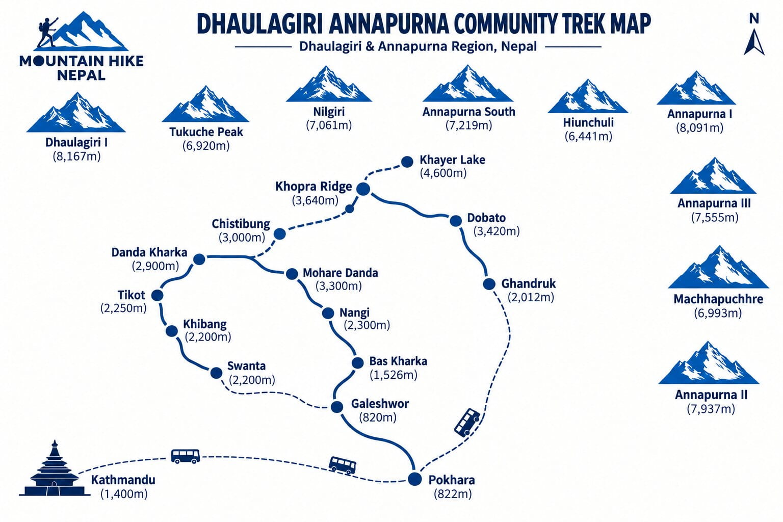
Kathmandu → Pokhara → Galeshwor → Bas Kharka → Nangi → Mohare Danda → Danda Kharka → Tikot → Khibang → Swanta → Chistibung → Khopra Ridge → (optional Khayer Lake) → Dobato → Ghandruk → Pokhara
Bas Kharka, Nangi, Tikot, Khibang, and Swanta are working villages, not stops built for passing trekking groups. The trek spends four nights across four of them — Bas Kharka, Nangi, Tikot, and Swanta — with Khibang passed through on the way to Swanta. Homestays here are run by the same Magar families who live in them.
Altitude gain is spread across ten trekking days rather than concentrated into two or three big pushes. Khopra Ridge, the standard route’s high point, sits at 3,640 metres, reached through forest and ridge trail rather than one steep final day.
Khayer Lake at 4,600 metres is optional, not compulsory. Day 10 can be a long mountain day to the lake, or a rest day around Khopra Ridge. That choice is made on the ground with your guide, not locked in before you arrive.
This is a moderate trek, not an easy one. Several days run 5 to 7 hours, and Day 10’s optional Khayer Lake side trip is 8 to 10 hours round trip at altitude. There’s no technical climbing, but a reasonable level of fitness and a few weeks of hill walking beforehand will make the middle days easier.
per person
Recommended
per person
per person
Value Added
per person
Altitude: 822m | Travel: Tourist bus, 6–8 hrs | Meals: Not included | Stay: Hotel, Pokhara
The drive out of Kathmandu follows the Prithvi Highway through the middle hills, tracking the Trishuli and Marsyangdi river valleys for most of the way. It’s a long day of driving rather than trekking — a chance to rest before the trek itself starts tomorrow. Pokhara arrives in the afternoon, with the Annapurna range visible from the lakeside on a clear day.
Altitude: 1,526m | Ascent: +704m (from Pokhara) | Drive + Walk: Local bus to Galeshwor, then 3–4 hrs on foot | Meals: Breakfast, Lunch, Dinner | Stay: Community Lodge, Bas Kharka
A local sharing bus runs from Pokhara through Beni to Galeshwor, where the road ends and the trek begins. From here the trail climbs through forest and hillside farmland to Bas Kharka, a small settlement on the Dhaulagiri side. This first walking day sets the pattern for the trek — short, steady climbs between villages rather than one long push.
Altitude: 2,300m (confirmed) | Ascent: +774m | Walking: 5–6 hrs | Meals: Breakfast, Lunch, Dinner | Stay: Community Lodge, Nangi
The trail continues through forest and terraced hillsides, passing small settlements before reaching Nangi — one of the larger, better-established communities on this side of the route. Nangi has a longer history of hosting trekkers than the villages either side of it, and the walking today is a genuine climb rather than a gentle stroll.
Altitude: 3,300m (confirmed) | Ascent: +1,000m | Walking: 6–7 hrs | Meals: Breakfast, Lunch, Dinner | Stay: Community Lodge, Mohare Danda
The longest single ascent of the trek so far, climbing through rhododendron and oak forest toward Mohare Danda. As the trail gains height, the forest thins and the first real mountain views open up — Dhaulagiri and Annapurna South both visible from the ridge on a clear day. This is a genuinely demanding day; budget the full 6–7 hours rather than rushing it.
Altitude: approx. 2,900m | Descent: -400m (net) | Walking: 5–6 hrs | Meals: Breakfast, Lunch, Dinner | Stay: Community Lodge, Danda Kharka
The trail leaves Mohare Danda and drops onto quieter ridge and hillside paths, moving further from the better-known trekking corridors. Forest gives way to open hillside sections with mountain views along the way. Danda Kharka’s altitude isn’t independently confirmed beyond your own route notes — treat it as approximate until we can verify it against a second source.
Altitude: approx. 2,250m | Descent: -650m (net) | Walking: 5–6 hrs | Meals: Breakfast, Lunch, Dinner | Stay: Homestay, Tikot
A descending day through forest and terraced hillside farmland to Tikot, a traditional Magar settlement on the Dhaulagiri side of the route. This is one of the villages where the trek’s community character is most obvious — accommodation here is homestay-style rather than a purpose-built lodge.
Altitude: approx. 2,200m | Descent: -50m (net) | Walking: 5–6 hrs | Meals: Breakfast, Lunch, Dinner | Stay: Homestay, Swanta
The trail passes through Khibang — a village walked through, not overnighted in — before reaching Swanta. This is one of the quieter stretches of the whole trek, with more direct contact with day-to-day village life than the busier Annapurna routes offer. Swanta’s altitude is disputed across sources (2,200m per your route notes vs. roughly 2,374m from an independent operator) — flagging this rather than picking one.
Altitude: approx. 3,000m | Ascent: +800m (net) | Walking: 5–6 hrs | Meals: Breakfast, Lunch, Dinner | Stay: Community Lodge, Chistibung
A steady climb back up through forest and mountain terrain. The landscape changes noticeably today as the route leaves the lower village belt and moves into the higher alpine environment around Khopra. Chistibung’s altitude, like Danda Kharka’s, isn’t independently confirmed beyond your own route notes.
Altitude: 3,640m (confirmed) | Ascent: +640m | Walking: 5–6 hrs | Meals: Breakfast, Lunch, Dinner | Stay: Community Lodge, Khopra Ridge
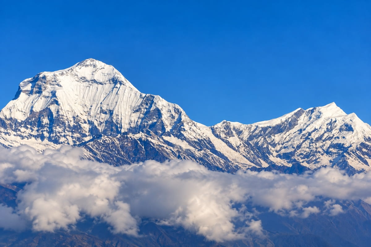
A steady climb to Khopra Ridge, one of the trek’s two high points. The ridge itself opens onto a wide panorama — Dhaulagiri, Annapurna South, and Nilgiri all visible from the same vantage point, without the crowds of the more established Annapurna viewpoints.
Altitude: 3,640m overnight / approx. 4,600m at Khayer Lake if taken | Walking: 8–10 hrs round trip, or a rest day at Khopra Ridge | Meals: Breakfast, Lunch, Dinner | Stay: Community Lodge, Khopra Ridge
An optional high-altitude day, decided on the ground with your guide rather than fixed in advance. Trekkers who want the longer day can walk to Khayer Lake, a high alpine lake beneath the Annapurna range — sources disagree on its exact altitude, ranging from roughly 4,600m to 4,767m, so treat any figure quoted (including ours) as approximate. Those who’d rather not commit to a 8–10 hour day can stay at Khopra Ridge instead.
Altitude: 3,420m (confirmed) | Descent: -220m | Walking: 6–7 hrs | Meals: Breakfast, Lunch, Dinner | Stay: Community Lodge, Dobato
The trail descends from Khopra Ridge through forest and mountain terrain toward Dobato. The landscape shifts again here, moving out of the Dhaulagiri-facing terrain and into the Annapurna foothills proper — this is where the trek starts to feel like it’s heading toward more familiar Annapurna territory.
Altitude: 2,012m | Descent: -1,408m | Walking: 5–6 hrs | Meals: Breakfast, Lunch, Dinner | Stay: Teahouse, Ghandruk
A long descent through forest to Ghandruk, one of the best-known Gurung villages in the whole Annapurna region. After several days on quieter community trails, Ghandruk is a noticeable shift — a larger, more established mountain settlement with a proper teahouse network, the first since Bas Kharka.
Altitude: 822m | Descent: -1,190m | Travel: Local sharing jeep, 3–4 hrs | Meals: Breakfast | Stay: Hotel, Pokhara
A local sharing jeep covers the final stretch from Ghandruk back to Pokhara, closing out the trek. The afternoon is free — most trekkers spend it around Lakeside, and this is also where any onward travel or extension gets arranged.
A 13-day community-based trek through the foothills between the Dhaulagiri and Annapurna ranges, running from Galeshwor to Khopra Ridge and Ghandruk. It spends most of its time in village lodges and homestays away from the main Annapurna corridor, reaching a high point of 3,640m at Khopra Ridge, or 4,600m with the optional Khayer Lake side trip.
Both start from Pokhara and reach similar altitudes, but this trek spends most of its time in community villages away from ABC’s busier main trail, with more homestay-style accommodation. It is a genuinely different route, not a shorter or easier version of ABC.
No technical climbing skills are needed, but a good level of general fitness is required. Most days run 5 to 7 hours, and some multi-day hiking experience makes the trek noticeably easier.
Yes. A licensed guide is legally required for Annapurna-region trekking, and it’s included as standard in every group size on this trek.
Yes, it’s offered as an optional Day 10 excursion from Khopra Ridge, an 8 to 10 hour round trip to 4,600m. Trekkers who prefer a slower day can stay around Khopra Ridge instead.
A mix of community lodges, homestays, and teahouses depending on the village — rooms are basic and usually twin-sharing, reflecting the trek’s community character rather than larger commercial teahouses.
ACAP (Annapurna Conservation Area Permit) and TIMS, both included in your package price and arranged before you arrive. Your guide carries and presents the paperwork at checkpoints along the route — you won’t need to buy or process anything separately, just bring your passport for identity checks.
Yes, we require proof of insurance before confirming your booking. It needs to cover trekking to this trek’s highest point — Khopra Ridge at 3,640m, or up to Khayer Lake’s altitude if you take that optional side trip — plus helicopter evacuation from the Annapurna region.
No. This trek is entirely road-based — tourist bus and local sharing transport between Kathmandu, Pokhara, and the trailhead, with no domestic flight leg anywhere in the itinerary. That means none of the Lukla-style weather cancellation risk that affects Everest region treks.
Yes. Many trekkers add a Poon Hill sunrise extension, extra time in Pokhara, or combine this with a shorter Annapurna itinerary. Customise your itinerary with us before booking and we’ll build the extension into your schedule.
Both. We price by group size from Solo through 8–12 trekkers, and any group within that range can book its own private departure date rather than joining a fixed schedule — message us with your preferred dates.
There’s no technical climbing anywhere on the route, and the daily pace can be adjusted with your guide, which makes it workable for capable older trekkers and older children with some hiking experience. The honest limiting factor is the 5 to 7 hour walking days, not age itself — talk to us about your specific situation before booking.
Yes. Every booking, including Solo, includes a licensed guide for the full route, and we’re a direct WhatsApp contact rather than a booking platform passing you to a subcontractor. If you’d prefer a female guide, tell us when you book and we’ll confirm availability.
Those are shorter routes that enter and exit the same general area more directly. This trek covers considerably more ground — starting from Galeshwor and passing through Bas Kharka, Nangi, Danda Kharka, Tikot, Khibang, and Swanta before ever reaching Khopra Ridge — so it’s a genuinely longer, more village-focused itinerary rather than a Khopra or Mohare Danda trek with a different name.
Day 10 is entirely optional and decided on the ground with your guide, not fixed in advance — you can rest at Khopra Ridge instead. If anyone feels unwell at any point on the trek, your guide manages the response and descent, and your insurance covers evacuation if it’s needed.